環境資訊中心外電;姜唯翻譯;林大利審校;稿源:Carbon Brief
根據,歐洲的泥炭地可能會從碳匯轉變為碳排放源,因為有1/4的泥炭地乾旱程度已達到2000年來最嚴重。
這種「大範圍」且「嚴重」乾旱趨勢與近期自然和人為氣候變遷趨勢吻合,也可能是因為泥炭地被用於農業和燃料而加劇。
同時有,北部地區泥炭地儲存的碳量可能是過去估計值的兩倍。
這兩篇論文都發表在《自然地球科學》(Nature Geoscience)期刊上,顯示有必要努力保護泥炭地作為高緯度地區的碳儲存場所。
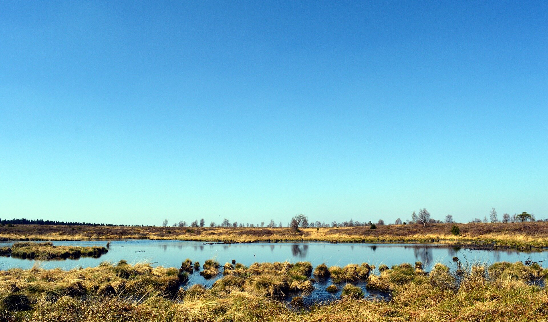
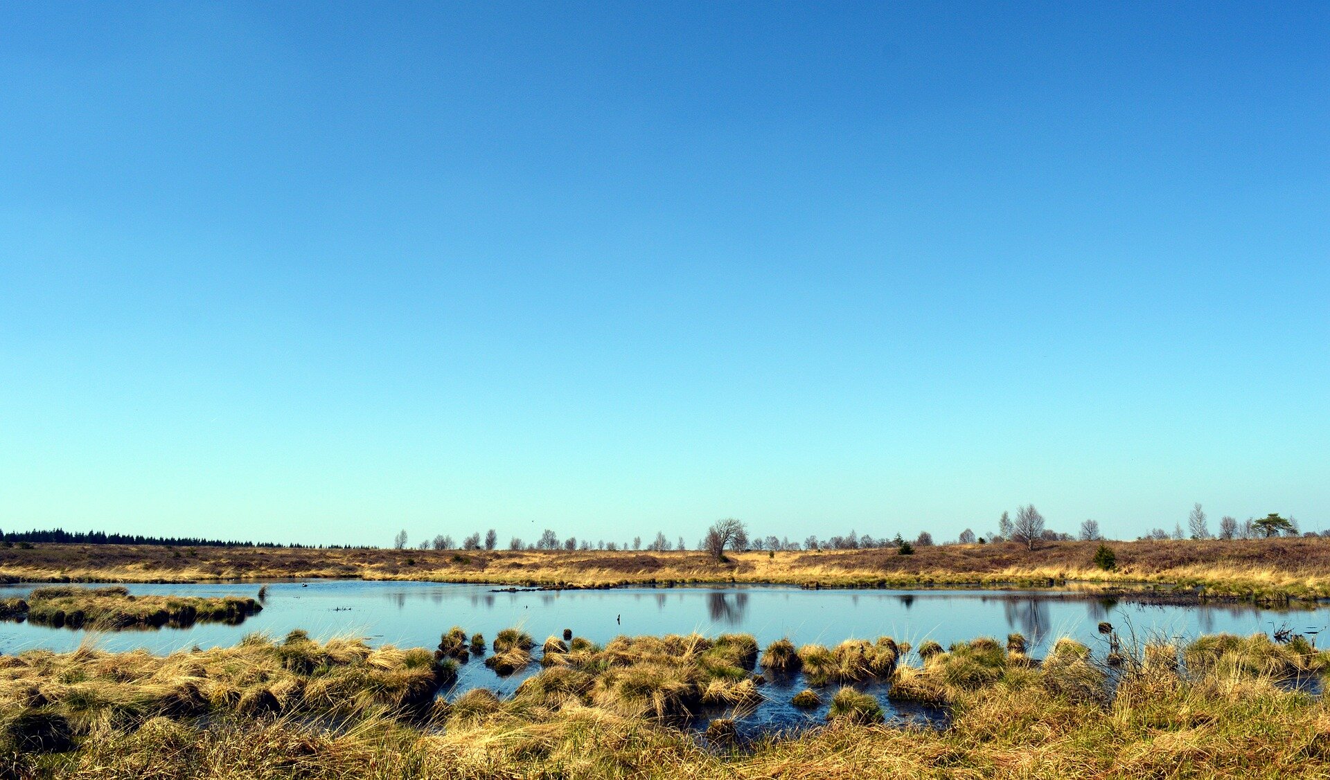 歐洲泥炭地乾旱程度達到令科學家緊張的程度。照片來源:裡茲大學(CC0)
受威脅的泥炭地
土壤積水情況延緩植物分解的速度時便形成泥炭地,死去的植物在此長時間層層累積。透過泥炭地,科學家能了解地球陸地表面如何排放和吸收碳。
儘管泥炭地僅覆蓋地球表面的3%左右,但土壤碳含量卻佔了大約五分之一。在歐洲,泥炭地生態系統儲存的二氧化碳比森林多五倍。
但是許多泥炭地生態受到威脅,部分原因是人類數百年來利用泥炭作為燃料或肥料。
受損的泥炭地是顯著的碳排放源,每年釋放約3.5%的全球人為二氧化碳排放量。
裡茲大學的研究人員、論文之一的主要作者史雲鐸(Graeme Swindles)博士介紹了歐洲乃至歐洲之外地區泥炭地生態系統面臨的各種問題:
「因為人類對泥炭資源或土地利用的需求,泥炭地面臨破碎化、水分排乾、燃燒、農業和綠化等威脅。氣候暖化和乾旱也是主要因素。」
雖然淹水的泥炭會繼續儲存碳,但氣候變動或人類破壞引起的擾動會使氧氣進入,觸發二氧化碳的釋放。
歐洲許多泥炭地已經顯示出這種跡象,其中植被從泥炭苔蘚變成草木和灌木。
 芬蘭Torronsuo國家公園的一處沼澤濕地。攝(CC BY 2.0)
乾旱趨勢
萊斯特大學濕地生態學家佩姬(Susan Page)教授肯定史雲鐸的研究。該研究確認了從斯堪地那維亞到波羅的海,整個歐洲泥炭地的乾旱趨勢,在最近200年間尤其明顯。佩姬向Carbon Brief解釋:
「泥炭地提供許多有益的生態系統服務,但常常被低估,包括碳儲存和封存,對減緩氣候變化有重要作用,其日漸乾旱的趨勢應受到關注。」
這個趨勢不只是人為活動所造成,但作者指出,歐洲泥炭地「可能正在偏離自然變化的基線」,其中又以英國和愛爾蘭的泥炭地最為嚴重。
由於缺乏長期的水文監測數據,科學家們利用沼澤中的微小變形蟲的殼來推測歷史水位。
他們分析了31個歐洲泥炭地的重建情況,發現從1800年到2000年,有60%的土地比過去600年更為乾旱。
此外,有40%的泥炭地處於1,000年來最乾旱的狀態,更有24%是2,000年以來最乾旱。
他們認為這反映了該地區氣候日益乾旱,人為影響可能加劇了這個趨勢。整體而言,研究人員在42%的測試地點發現重大破壞,另有29%遭受輕微破壞。
但是史雲鐸強調,他們的研究工作大多在歐洲最完好的土地上進行…因此許多泥炭地的狀況會更糟。
第二篇論文讓史雲鐸的研究結果更顯重要。第二篇研究指出,歐洲泥炭地儲存碳的作用可能比過去所知更大。
 英國湖區的泥炭地。照片來源: (CC BY-NC-ND 2.0)
碳儲存估算結果倍增
紐約哥倫比亞大學的尼可斯(Jonathan Nichols)教授和同事皮特(Dorothy Peteet)教授的研究估計,北部泥炭地儲存著大約10,550億公噸的碳。2010年理海大學餘自成(Zicheng Yu,音譯)博士等人在同一地區估算出的數據則是5,470億公噸。
尼可斯說,過去的研究沒有將適當將未採樣地區納入估計,如亞洲和南部歐洲。
他說,泥炭地的碳通常使用「歷時法」測量,將各個地點的碳隨時間累積的速率求平均值,再加上泥炭地的面積以求出總碳量。
根據他們的論文,過去使用此方法的研究已受到「幾個已知的採樣偏差來源」的影響。
兩位作者強調了這樣一個假設:泥炭隨時間的累積速率是全球氣候的結果,因此北半球的泥炭地都相似。
尼可斯向Carbon Brief解釋在此假設下他們的方法如何改善估計精準度:
「最大的差異在於如何求所有不同地點的平均水準……人們用來衡量碳累積率的大多數地點都在西北歐洲和加拿大,因此計算會偏向那些地方,而遠離其他地方……(我們試著)根據地區加權平均值,而不是根據已進行的測量次數任意加權。」
研究人員使用4,000多個放射性碳測量值來確定645個泥炭地測試點的泥炭年齡。
他們將來自Neotoma古生態學資料庫先前未使用的數據與新的計算方法結合,估算碳累積的歷史以及泥炭地的形成時間。
 位於拉脫維亞的大凱邁裡(Great Kemeri)沼澤區。來源: (CC BY 2.0)
潛在問題
Carbon Brief採訪了許多科學家,他們對尼可斯和皮特的分析感到驚訝,因為他們的碳儲量估計比過去大很多。有人對他們的估計方法提出了疑問。
2010年泥炭地碳累積研究主持人餘博士告訴Carbon Brief,他很高興看到這樣的論文取得了可觀的進展,但他擔心其中可能有「重大技術缺陷」而必須修訂。
他告訴Carbon Brief,這個領域的科學家很早就認同必須考量泥炭地之間的區域差異,但缺乏足夠的資料來這麼做:
「在這方面,新論文透過計算八個泥炭地區中每個區域的碳累積率來解決空間偏差,很可能是重大的進展跟改善。」
(新研究的作者主要依據政治邊界將北部的泥炭地分為八個區域。他們還設計了另外兩種劃分區域的方式,以消除任何偏誤。)
餘自成說,據他所知,儘管泥炭地之間存在已知的差異,但尼可斯和皮特必須用一個平均碳密度值代表所有站點「很可惜,但也許無法避免。」
透過合併以前被忽略的數據,新論文的作者納入了通常不被視為「北部」泥炭地的地點,包括南歐某些地區,甚至還有北非的一些地區。
餘自成認為,這兩個因素的結合導致對北部泥炭碳儲存量的高估。
尼可斯在回應此批評時告訴Carbon brief,除了平均碳密度以外,他們還納入有16,000個測量值的大量分佈,因此能考慮到相當大的變化和不確定性。至於採納更多地點,他說「基於這份研究的觀點,這麼做是對的」:
「我們要根據已知泥炭地的所在來測量泥炭地的碳,而非根據假設的泥炭地所在。」
實際上,這表示該研究包括了過去不納入研究的區域(包括泥炭地比較少的地區)的數據。整體而言,他說,他們的方法旨在產生「更大的不確定性」,但最終結果比過去的研究更接近「真實」答案。
 芬蘭北部奧伊湖(Oijärvi)附近一處沼澤溼地。(CC BY 2.0)
真正的問題
這兩篇論文強調泥炭地對科學家了解氣候系統的重要性,以及維護和恢復泥炭地的必要性。
阿伯丁大學土壤學專家、政府間氣候變遷專門委員會的作者史密斯(Pete Smith)教授沒有參與任何一項研究,他對Carbon brief表示:
「綜觀這兩份研究,它們顯示高緯度泥炭地是重要的碳匯,因為泥炭地面積和碳儲量都在成長,但是一旦變得乾旱,則可能從淨碳匯變成碳排放源,這是真正的問題。」
他指出,儘管史雲鐸的論文顯示泥炭地變乾的現象可能還沒有超出「正常的泥炭地乾濕週期,但偏離長期基準表示逼近一個臨界值,超過這個臨界值則泥炭形成會轉為泥炭降解,導致大量的碳進入空氣。」
佩姬說,特別令人擔憂的是,這些擾動和人類活動的結合會產生「累積效應」。
史雲鐸和他的團隊寫道,歐洲泥炭地正處於「過渡狀態」,已經採取一些措施,像是堵塞人工排水溝和溝渠來恢復部分泥炭地。
他們指出,這些行動對於防範人為影響和未來的全球暖化可能非常重要。他們說要採取這些措施必須參考他們的研究發現。
尼可斯表示,考慮到泥炭地面臨的威脅,對於科學家而言,調查全世界可用的泥炭總量很重要,才能計算有多少可以損失:
「泥炭地通常不被當成全球氣候模型的一部分。但如果我們想對未來的氣候做出現實的預測,泥炭地就必須成為一部分。」
Europe’s carbon-rich peatlands show ‘widespread’ and ‘concerning’ drying trends by Josh Gabbatiss
European peatlands could turn from carbon sinks to sources as a quarter have reached levels of dryness unsurpassed in a record stretching back 2,000 years, according to a new study.
This trend of “widespread” and “substantial” drying corresponds to recent climate change, both natural and human-caused, but may also be exacerbated by the peatlands being used for agriculture and fuel.
It comes as another study estimates that the amount of carbon stored in peatlands across northern regions could be as much as double previous, widely reported estimates.
The papers, both published in Nature Geoscience, indicate a need for efforts to conserve peatlands as sites of carbon storage at higher latitudes.
Taken together, the findings are “a real concern”, according to one scientist not involved in the research, given the key role these ecosystems play in the global carbon cycle.
Threatened peat
Peatlands when waterlogged conditions slow down plant decomposition, meaning layers of dead plants accumulate over many years as peat. They are a vital component in scientists’ understanding of how the planet’s land surface emits and takes up carbon.
Despite only covering around 3% of the Earth’s surface, peatlands contain of its soil carbon. In Europe, these ecosystems store more CO2 than forests.
However, the existence of many peatlands is under threat, partly thanks to centuries of human exploitation of peat as a or .
Damaged peatlands are a significant source of emissions, 3.5% of global anthropogenic CO2 emissions each year.
, a researcher and lead author of one of the papers, lays out the various issues facing these ecosystems in Europe and further afield:
“Cutting, drainage, burning, agriculture, afforestation. All driven by need for peat as a resource or for land-use practices not in line with keeping healthy peatlands. Climate warming and drying is also a major factor in tandem with these.”
While waterlogged peat will continue to store carbon, disturbances resulting from climate fluctuations or humans damaging these ecosystems allow oxygen to enter it, triggering the release of CO2.
Many European peatlands have already shown evidence of this transition, as the vegetation they support shifting from peat mosses to grass and shrubs.
Drying trend
The , produced by Swindles and a large international group of scientists, was welcomed by wetland ecologist as a “robust piece of work” – and one with some significant implications.
It identifies a drying trend across European peatlands, from Scandinavia to the Baltics, that has become particularly pronounced in the last 200 years. Page explains to Carbon Brief:
“This trend should be of concern given that peatlands deliver a range of beneficial, but often undervalued ecosystem services, including carbon storage and sequestration and, therefore, have an important role to play in climate mitigation.”
While the results are not merely the result of human interventions, the authors note that European peatlands “may now be moving away from natural baselines”. The results were most severe for peatlands across Great Britain .
As there is no long-term hydrological monitoring data available, the scientists use the presence of shells (or “tests”) from tiny, to gauge historic water levels.
They analysed reconstructions of 31 European peatlands, concluding 60% of the sites were drier from 1800 to 2000 than they had been for the last 600 years.
Furthermore, 40% of sites were at their driest in 1,000 years, and 24% were drier than they had ever been across the entire 2,000-year record.
While they concluded that this effect mirrored an increasingly dry climate in the region, they also note that human influence in peatlands is likely to have exacerbated the trend. In total, they identified significant damage by people in 42% of the sites and a further 29% suffering from minor damage.
However, Swindles notes that they “mostly worked on the most intact sites in Europe…so there are many more that have suffered drainage far worse than this”.
These results could be particularly significant in light of the second paper, which suggests the role played by European peatlands in storing carbon may be even greater than previously imagined.
Doubling storage
In , and his colleague , both at in New York, estimate that northern peatlands store approximately 1,055 gigatonnes (Gt) of carbon.
They compared this to a made by from and his collaborators back in 2010, who arrived at a figure of 547Gt for the same region.
Nichols explains their work to Carbon Brief, noting that past analyses did not properly account for undersampled regions, such as Asia and Southern Europe.
Peatland carbon, he says, is normally measured using a “time-history method” that involves averaging together the rate at which carbon has accumulated over time at a variety of sites, combined with the area of the peatland to get the total amount of carbon.
According to their paper, past attempts that have used this method have been affected by “several known sources of sampling bias”.
Specifically, the pair highlight the assumption that peat accumulation rates over time are the result of the global climate and are, therefore, similar across the northern hemisphere.
Nichols explains to Carbon Brief how their method improves on this assumption:
“The big difference is how I average all the different sites together…Most of the sites that people have measured carbon accumulation rate at are in Northwest Europe and Canada. So you basically bias your calculations towards those places and away from other places…[We tried to] fix that problem by weighting our averages based on area, instead of arbitrarily based on how many measurements had been made.”
The researchers used over 4,000 radiocarbon measurements to determine the age of peat from 645 peatland sites.
They incorporated previously unused data from the , together with new computer algorithms for estimating the history of peat carbon accumulation and when peatlands were formed.
Nichols notes that while their final figure for carbon storage is considerably higher than previous data-driven efforts, modelling studies have already yielded higher figures:
“If you used an earth system model to predict how much peat there should be, it’s usually more than what we get when we measure, so hopefully this will make it so they are more in line.”
Potential shortcomings
Carbon Brief talked to a number of scientists who expressed surprise at Nichols and Peteet’s analysis, given the far larger estimate of carbon storage it yielded. Others raised questions about the methods the pair had used to arrive at their final figure.
Yu, who led the team that arrived at the 2010 peatland estimate, tells Carbon Brief that while he is pleased to see such a paper achieving prominence, he is concerned there are “major technical shortcomings” that have led to this considerable revision.
He tells Carbon Brief that while scientists working in this area have “long recognised” that accounting for regional differences between peatlands is the “right way to go”, lack of sufficient data has hampered their efforts:
“In this regard, this new paper has made a potentially important progress and improvement by attempting the calculations of carbon accumulation rates for each of eight peat regions, with a goal to account for spatial bias.”
(As part of their analysis, the researchers divided northern peatlands into eight regions, based mainly on political boundaries, that tend to be reported in scientific literature. They also devised two other ways of dividing the region up to eliminate any biases.)
Yu goes on to say that it is “unfortunate and perhaps unavoidable” that, from what he could tell, Nichols and Peteet had to use a single average carbon density value for all sites, despite the known variation across peatlands.
He adds that by incorporating previously overlooked data, the authors of the new paper have included sites that would not normally be considered under the category of “northern” peatlands. Among these are some parts of southern Europe and even a couple in North Africa.
Yu says that, in his view, the combination of these two factors has led to an overestimation of the amount of carbon storage provided by northern peat.
Responding to this criticism, Nichols tells Carbon Brief that beyond the average carbon density, they also took into account the considerable variation and uncertainty by incorporating a large distribution of values based on 16,000 measurements. As for the wider array of locations, he says this “gets right at the point of the paper”:
“We set out to measure carbon in peatlands based on where we know peatlands to exist, not where we assume them to be.”
In practice, this means including data from unconventional areas, including regions where peatlands are sparse. Overall, he says their methods were designed to produce “much wider uncertainties” but also a final result that is closer to the “real” answer than previous attempts.
‘Real concern’
The publication of these two papers serves to highlight the importance of peat for scientists’ understanding of the climate system, as well as the need to preserve and restore peatlands.
, a soils expert at the and author who was not involved in either study, tells Carbon Brief:
“Taken together, the studies suggest that high-latitude peatlands are acting as a significant carbon sink, as they are growing in area and carbon stock – but, if they are also drying, there is potential that they could turn from net carbon sinks to sources. Given the huge store of carbon in high latitude peatlands, that is a real concern.”
He notes that while the Swindles paper suggests drying may not yet be beyond “normal peatland drying cycles”, the shift away from long-term baselines “may be pushing them closer to a threshold whereby peat formation is replaced by peat degradation, which would lead to massive losses of carbon to the atmosphere”.
Page says a particular concern is that a combination of these perturbations and human activities have a “cumulative effect”.
Swindles and his team write that with European peatlands in a “state of transition”, there are to restore some of them by damming artificial drains and gullies.
They note that these actions may be “vital” in protecting against both human impacts and future global warming. They say these initiatives must take their findings into account.
For his part, Nichols says that considering the threats facing peatlands, it is important for scientists to investigate the total volume of peat available across the world, in order to “put a number on how much there is to lose”:
“Peatlands are not usually part of global climate models. If we want to make realistic predictions of future climate, peatlands need to be a part of it.”
※ 全文及圖片詳見:()
參考資料
- Swindles, GT et al. (2019) Widespread drying of European peatlands in recent centuries, Nature Geoscience,
-
- Nichols, JE and Peteet, DM (2019) Rapid expansion of northern peatlands and doubled estimate of carbon storage, Nature Geoscience,
※ 本文與 行政院農業委員會林務局 合作刊登
作者
如果有一件事是重要的,如果能為孩子實現一個願望,那就是人類與大自然和諧共存。
於特有生物研究保育中心服務,小鳥和棲地是主要的研究對象。是龜毛的讀者,認為龜毛是探索世界的美德。
本站聲明:網站內容來源於https://e-info.org.tw/,如有侵權,請聯繫我們,我們將及時處理
【其他文章推薦】
※AVX代理商及NICHICON代理商授權有哪幾家?
※怎麼檢測NBR手套規格是否有符合國家認証規定?
※大樓隔熱紙施工分享說明,教你如何善用空間裝潢、設計 !
※買不起高檔茶葉,精緻包裝茶葉罐,也能撐場面!
※塑膠射出模具射出成型過程大公開 !
※廢氣洗滌塔設計及注意事項 ?